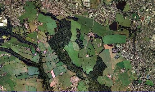
Judy Woods is a the 3 rd largest Woodland on Bradford which aprox 40 Ha but with adjoining trees in Calderdale . The Collective term Judy Woods is given to the composite Woodlands, hence it wont be obvious on the Ordnance Survey Maps. The woodland is situated on Coal Measures and this is reflected on the surrounding hill slopes , (Follow slope round from Fenwick Drive where it will turn into the woodland the steep sided valley containing Royds Hall Beck which is designated a site of Geoloigal Interest ). The whole area therefore reflects the History of Industrial revolution. Present in the Woodland are numerous Bell Pits which have been used to provide coal.Amos Kellett owned the land for a time, and then sold it to Mr Smith of Royds Hall. The wood itself may have been a part of the larger Wibsey wood and Forest of Brianscholes.
Parts of the woods are known by their own names, including: Doctor Wood, Gannerthorpe, Jagger Park Wood, Low Wood, Neddy Wood, North Brow Wood, Old Hanna Wood, Royds Hall Great Wood
Click on this link if you wish to have a Map suitable for walking showing clearly access and Rights of Way
These Woodlands are
North Brow Woods - Overlooks the estate at Woodside and can accessed from Meadway
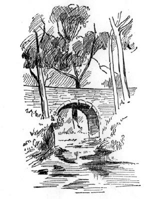
Royds Hall Great Wood - Derives from its historical association from the Hall Runs from Brow Woods over to Horse Close Bridge or " Judy Brig "
Gannerthorpe Wood - there is no public access into this wood but it can be viewed from Public FP 129
Old Hanna Wood - Stretches from the bridge towards Delph Hill between High Fernley Road and Royds Hall Lane. Old Hanna may have been the mother of Anne Wood who married James Hanson of Woodside Farm in 1729. On some Low Moor Company maps it is referred to as Neddy Wood.
Low Wood - This is the woodland that can be accessed from Station Road or on the left behind Woodside farm on the High Fernely road approach.. It is the lowest wood so maybe that is how it got its name it contains plants of marshy ground
Jagger Wood - Is on the Calderdale managed side of the woodland and is on the right as you go into Royds Hall Great Wood from Meadway. A “jagger” is a local word for peddler or drover
Sun & Shelf Woods Although a part of the overall woodland network which would have once bee the Old Forest of Bryanscholes these inoportant , linked and bordering woodlands form an important picture with other woodlands forming Judy Woods and have their own fotpath network managed by Calderdale Council
Royds Hall Dam
In the vicinity of the Woodland is a reservoir known as Royds Hall Dam . This Dam has become a haven for Wildlife and increasingly growing number of Water Fowl. This probably is a direct result of extensive stocking by the local Angling Club , Bradford Number 1 Anglers
Water Birds include Coote , Swan ,Geese, Mallard
The reservoir is stocked with fish such as Crucian Carp Roach and Bream and potentially contains a protected species - The native British Crayfiish
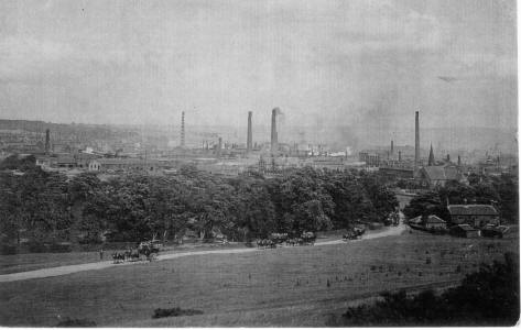
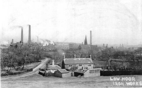
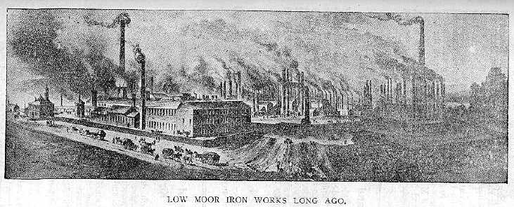
The dam was a holding basin for the nearby Low Moor Iron Works .
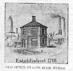
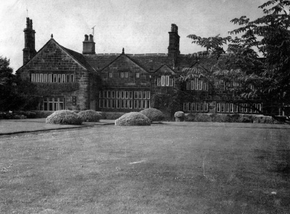
Royds Hall Dam Low Moor Moor Iron works the company even printed their own pound notes !! To learn more about Low Moor Iron Works Click this link. The old Fly wheel can still be seen at Common Road Low Moor Iron works Royds Hall is a large manor house dating from the 13th century. The estate was broken up in the 70's to leave the Hall, The Farm and its Land Horseclose Cottages and the Royds Hall Cottages. The Manor has adjacent the remains of an old manorial court.To read more including a historical account of the Hall click on the link below
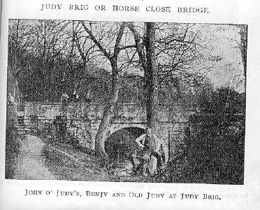
Royds Hall Manor - The History Horse Close bridge Then and Now................... 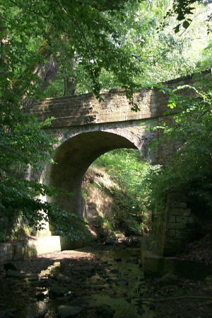
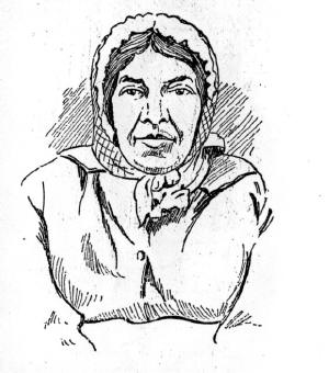
Who was Judy ? The name of the woodland is derived from Judy North or “Gurt Judy” who lived in a cottage near Horse Close Bridge in the 1850s and 60s. In the census of 1861 Judy is described as “seller of sweet meats” no doubt to the visitors to the gardens. Judy was the second wife of Joseph North whose family had managed the “pleasure gardens” on the hillside by the bridge since the early 1800’s. Following Joseph’s death in 1850, first Judy herself and then John Barraclough, Judy’s son by her first marriage took over as gardener.
Days Gone By ! Here ia a snapshot of the area around Brow Woods - Royds Hall - Park Dam around the period of 1852-1854 you can see the Coal Pit just off The Lane up to the farm and also on dry summers the mineral line can be followed from the hill view by eye making its way round the Dam on the Gradients to the mineral House on Abb Scott Lane , The area below the Park Dam known as Woodbottom still exists . Since the Dam was used as a holding reservoir for the Low Moor Iron Works it is interesting to speculate as to how water got there . There is a fording into the dam with hefty stone supports and cobbles on the Delph Hill side . It is likely that a steam engine may have pumped from here or towed trams on the mineral line . This was the first of two dams , the smaller of which was on the Delph Hill School site which is no more although part remains as a the remnants of the school pond which developers must be minded to keep, No photographs or records can be found . The Picture above shows the Low Moor Works with the visible woodland being Woodbottom.
Who Lived In These Parts ???? Find out more with this link Read the 1871 Census link as you walk across the wood toRoyds hall and onward to Buttershaw Low Moor Photographs and History This link contains numerous photographs of old history in the Low Moor Area well worth a visit to by gone days